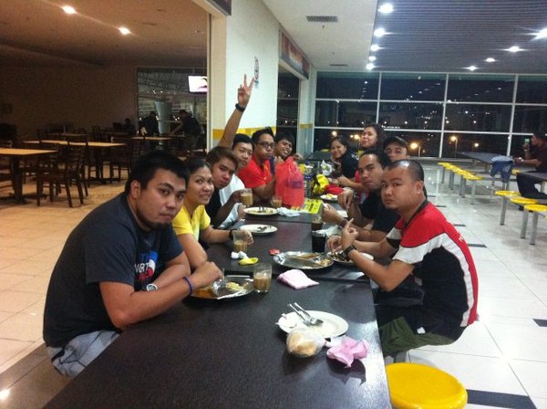
Hungy Games Teaser!
Saturday, October 13, 2012
Saturday, September 15, 2012
Gunung Bunga Buah
Altitude: 1430 masl
Location: Gothong Jaya, Malaysia / Genting
Highlands
14 – 16 September 2012
Itinerary
Day 1 – Sept 14
2200 Meet
up at Woodlands Bus Interchange
2230 ETD from Woodlands Bus to Larkin
Day 2 – Sept 15
0030 ETD Larkin
to Kuala Lumpur (Putra Sentral)
0430 ETA at KL / Breakfast / Prepare for Pack Lunch
0700 Taxi
going to JOP of Gunung Bunga Buah (Gothong Jaya) – 900masl
0930 ETA at JOP
0900 Start
of trek and ETA at Campsite
1400 ETA at campsite / Setup Camp
1500 Ascend
to Summit and Enjoy the Scenery (Picture taking)
1630 Prepare
for Dinner
1800 Dinner
and Socials
2300 Lights
Out??
Day 3 – Sept 16
0600 Wake-up
call / Prepare for Breakfast
0700 Breakfast
0800 Break
camp and Prepare for Descend
0900 Start
Descend / Estimated time of Arrival to JOP
1200 ETA at JOP / Prepare back to Kuala Lumpur (TBS)
1300 ETD JOP to Batu Caves (Optional) – by taxi
1330 Side
trip - Batu Caves (Optional)
1400 Batu
Caves to TBS – by taxi
1430 Lunch
1600 ETD from TBS to Larkin Bus terminal
2000 ETD Larkin
to Singapore (Home Sweet Home)

..bwahekhekhek
Wednesday, August 29, 2012
KALASAG Major Climb
Low's Peak - Mount Kinabalu (4095.2 masl) + Padas! v2
Trail: Mesilau Gate --> Laban Rata --> Low's Peak --> Laban Rata --> Timpohon Gate
August 24 - 29, 2012
Sabah Malaysia
Day 0 / August 24 - the Meet Up.
1530 Meet - up at Changi Airport Terminal 1. Everyone is on time, no late hanep!
1740 Depart from Changi Airport Terminal 1
2100 Depart from KIA to hostel / Dinner yeah!
2300 Lights Off!
1200 ETA at Pangi Station
..salamats sa mga kinuhanan namin ng picture bwahekhekhek
Trail: Mesilau Gate --> Laban Rata --> Low's Peak --> Laban Rata --> Timpohon Gate
August 24 - 29, 2012
Sabah Malaysia
Day 0 / August 24 - the Meet Up.
1530 Meet - up at Changi Airport Terminal 1. Everyone is on time, no late hanep!
1740 Depart from Changi Airport Terminal 1
..excited! at Changi Airport Terminal 1
2005 ETA at Kota Kinabalu International Airport (T2) 2100 Depart from KIA to hostel / Dinner yeah!
2300 Lights Off!
sarap!
Day 1 / August 25 - the Rafting!
0600 Wake - up call
0700 Depart from hostel
0930 Arrived at Beaufort / Breakfast
1000 Depart from Beaufort - by train, cool!!
![]() |
| too0toott!! |
1200 ETA at Pangi Station
1230 Start rafting. Everyone is excited! ..and thrill!! hahaha
![]() |
| are you ready for loOo0ong!!? |
Let the paddle begin! 9km distance and 7 thrilling, exciting, stirring and tough rapids! These 7 rapids (Merry-Go-Round, Break Point, Scooby Doo, Cobra, Curve, Lambada and Head Hunter) will make you feel what their name means whew! After 2 long hours of paddling, finally we completed the course without the boat overturn. Then everyone jumped in the river to swim except for one! He's scared of drowning!? "Your wearing a life vest Jeff!" :p
great job guys!
Tired and exhausted after rafting, we need to relax and recharge! ehem!

Day 2 / August 26 - Free and Easy (agad!?)
0600 Free and easy / Breakfast / Lunch
Day 3 / August 27 - the Climb!
0600 Wake up call / Breakfast / Register
0600 Free and easy / Breakfast / Lunch
1300 ETD from hostel
1600 ETA at Mount Kinabalu Headquarters / Register
1800 Dinner
1600 ETA at Mount Kinabalu Headquarters / Register
1800 Dinner
2100 Lights Off!
Mt Kinabalu HQ
the kids, the oldies and the ladies!
view of Mt Kinabalu at HQ
dinner time!
Day 3 / August 27 - the Climb!
0600 Wake up call / Breakfast / Register
0800 ETD at Mount Kinabalu Headquarters
0900 ETA at JOP (Mesilau Gate)
0930 Start trek
1700 ETA at Laban Rata (3273masl) / Dinner
2000 Light Off!
Day 4 / August 28 - Trek to Summit..
0100 Wake up call / Breakfast
0900 ETA at JOP (Mesilau Gate)
0930 Start trek
1700 ETA at Laban Rata (3273masl) / Dinner
2000 Light Off!
Mt Kinabalu HQ
..at Mesilau Gate
lunch time..
Day 4 / August 28 - Trek to Summit..
0100 Wake up call / Breakfast
0200 Start trek to summit
0400 ETA at Sayat Sayat Hut / Register
0600 ETA at Low's Peak (yeah!)
0800 Start descend
1100 ETA at Laban Rata / Lunch
1200 Resume trek
1600 ETA at Timpohon Gate
1700 ETA at Mt Kinabalu HQ / Dinner
2000 Back to hostel / Celebration!
Day 5 / August 29 - Uwian na!
0400 ETA at Sayat Sayat Hut / Register
0600 ETA at Low's Peak (yeah!)
Congrats KALASAG!
0800 Start descend
1100 ETA at Laban Rata / Lunch
1200 Resume trek
1600 ETA at Timpohon Gate
1700 ETA at Mt Kinabalu HQ / Dinner
2000 Back to hostel / Celebration!
Day 5 / August 29 - Uwian na!
Saturday, July 28, 2012
Gunung Datuk

Altitude: 870m / 2900ft
Location: Negeri Sembilan, Malaysia
28 – 29 July 2012
Itinerary
Day 1 - July 28 (Saturday)
0630 Meet-up
at Woodlands Bus Interchange
0700 Depart
from Woodlands Bus Interchange to Larkin
0800 ETA
at Larkin / Secure bus ticket going to Melaka Sentral
0830 Larkin
to Melaka Sentral
1130 ETA
at Melaka / Lunch and Secure ticket going back to Singapore
1230 Taxi
going to JOP
1330 ETA
at JOP / Secure payment to rangers’ station and Final prep
1400 Start
of trek
1800 ETA
at Campsite / Set-up camp and Prepare for dinner
2000 Dinner
and Socials
2300 Lights
out
Day 2 - July 29 (Sunday)
0600 Wake-up
call / Prepare for breakfast
0700 Breakfast
0730 Ascend
to summit
0830 Break
camp and Prepare for descend
0900 Start
descend
1200 ETA
at JOP / Prepare back to Melaka / Packed lunch
1300 JOP
to Melaka
1400 Side
trip to Melaka (Food Trip)
1900 Depart
from Melaka Sentral to Larkin
2200 ETA
at Larkin
2300 Back
to Singapore

27 - 28 April 2013

..bwahekhekhek
Sunday, June 10, 2012
The Freedom Climb 2012
Gunung Rajah
This
is my first freedom climb ever. We're supposed to hike in Gunung Hantu
Besar (Ghost Mountain) but unfortunately our guide there informed us
last minute that the trail was closed and we're no longer allowed to
camp. Our Team Leader, Ernie initiated to climb Gunung Rajah instead and
thought that it would be the best way in which we don't have to waste
our expensive bus tickets that was bought beforehand.
To be honest, I agreed to join this Freedom climb without a proper training and at that time I really had no idea where this mountain is nor how high it is, and from what I have learned from others who already climb Rajah - the trek is going to be TOUGH. Phew.
Gunung Rajah is located in Pahang and most trekkers start the trek from the foot of Chamang Waterfall in Bentong, Pahang. Physical fitness and stamina was more than a pre-requisite for this trek and the total distance covered was approximately 32km and that was inclusive of the long undulating logging trail in the beginning.
We
have successfully reached the summit of Gunung Rajah for a whole day
non-stop trek. Due to time constraints, we compressed this climb to 2
days/ 1 night itinerary. It requires one to trek through the initial
logging trail which feels really far and long! After which we trek along undulating terrains of the logging trail then reached the steep slopes of the gorge. The
path becomes narrow after the gushing rapids along the logging
trails. The trail gets steeper and muddy. Good thing is that there's no
sights of leeches. It was not easy trekking up to the campsite as one
would have to circumvent many fallen tree trunks, and have to navigate
through muddy and steep terrains. A trek where all of us should keep a
reasonable safety distance between one another.Not
long after ascending to the steep and muddy slopes, we cross a few
rivers before reaching the campsite. It was a sigh of relief. Thank God
as well, we were blessed and fortunate for the good weather. We
pitched our tents at the campsite, rested for a while and continue
to climb. Each of us must have that eager "summit push." We were all
careful of our handholds and footholds while ascending.
It's just 4pm and it was getting cold already and the air was moist. We began to gain more body heat while scrambling through the uneven mossy forest on that afternoon then VOILA! Signs of ropes were seen just after the false summit. Geez. The actual summit is a vertical rock face with ropes slinging by the side to assist the us all up to the top.
We
have reached the summit just before the sun sleeps. And it was very
beautiful. The sight of Genting Highlands far right, the exquisite
mountain ridges plus the enchanting sea of clouds. It was indeed
breathtakingly perfect, a worth of long and tiring trek.
Height : 5,526 feet (1685 meters)
9-10 June 2012
Distance to campsite approximately 6-7 hours and another 2 hours to the peak.
Day 1
00:00 BUS: Larkin to Bentong, Pahang
04:00 ETA Pahang / Breakfast
06:00 Taxi to Chamang Waterfalls
08:00 Start Trek / Adventure begins
13:00 Lunch / Rest
14:00 Continue Trek
16:00 Reach Campsite - 7hrs
17:00 Continue Trek to summit
19:00 SUMMIT + photo session
20:00 Descend / night trek
22:00 Reach camp Site / Socials
23:00 Lights Off
Day 2
06:00 Rise and Shine
08:00 Breakfast / Break Camp
11:00 Descend
13:00 Lunch at the White Rock/ Swim-swim
14:00 Continue Trek
16:00 Reach the long and effin' logging trail
17:00 Reach Lata Chamang Waterfalls/ Clean- up
18:00 ETA; Taxi to Bentong - KL
20:15 Reach TBS KL Bus Station; Off to Singapore
02:00 HOME SWEET HOME :)
Day 1
00:00 BUS: Larkin to Bentong, Pahang
04:00 ETA Pahang / Breakfast
06:00 Taxi to Chamang Waterfalls
08:00 Start Trek / Adventure begins
13:00 Lunch / Rest
14:00 Continue Trek
16:00 Reach Campsite - 7hrs
17:00 Continue Trek to summit
19:00 SUMMIT + photo session
20:00 Descend / night trek
22:00 Reach camp Site / Socials
23:00 Lights Off
Day 2
06:00 Rise and Shine
08:00 Breakfast / Break Camp
11:00 Descend
13:00 Lunch at the White Rock/ Swim-swim
14:00 Continue Trek
16:00 Reach the long and effin' logging trail
17:00 Reach Lata Chamang Waterfalls/ Clean- up
18:00 ETA; Taxi to Bentong - KL
20:15 Reach TBS KL Bus Station; Off to Singapore
02:00 HOME SWEET HOME :)
![]() |
| Woodlands Meet-Up |
| Breakfast at TBS Bus Station |
To be honest, I agreed to join this Freedom climb without a proper training and at that time I really had no idea where this mountain is nor how high it is, and from what I have learned from others who already climb Rajah - the trek is going to be TOUGH. Phew.
Gunung Rajah is located in Pahang and most trekkers start the trek from the foot of Chamang Waterfall in Bentong, Pahang. Physical fitness and stamina was more than a pre-requisite for this trek and the total distance covered was approximately 32km and that was inclusive of the long undulating logging trail in the beginning.
![]() |
| Take 5 :) |
![]() |
| Adam and Eve's Tree |

It's just 4pm and it was getting cold already and the air was moist. We began to gain more body heat while scrambling through the uneven mossy forest on that afternoon then VOILA! Signs of ropes were seen just after the false summit. Geez. The actual summit is a vertical rock face with ropes slinging by the side to assist the us all up to the top.

![]() |
| Rewarding view indeed |
![]() |
| Group Hug |
![]() |
| The Girls |
![]() |
| Summit Hug <3 span="span">3> |
![]() |
| The Boys!! |
![]() |
| At the camp site |
Photo Credits to: Tere Dilaw, Billy boy, Masayahing John and Tyrone :)
Thanks to all the organizers of this freedom climb.. Till next climb my dear friends!!!!!
Narrated by:
Harot :)
Subscribe to:
Posts (Atom)